Flooding in Texas will be intensified by sinking land
The land is sinking and the sea is rising, meaning Texas floods will be more severe. (AP Photo/Gregory Bull)

Houston and other areas in the southeastern part of the Lone Star State are likely to face worsened flooding later this century due to the combined impacts of sea level rise and a gradual sinking of the land, scientists have reported.
The team used estimates from satellite data and climate change projections to explore a range of possible future scenarios and found that this sinking, or subsidence, could increase the area vulnerable to flooding by up to nearly 40% over the effects of sea level rise alone. The researchers, whose study was published March 27 in Geophysical Research Letters, say their findings are relevant to developers and risk managers.
"Recent storms definitely showed us that this area in particular has a high population living relatively close to the coast, and that it's important to model the different scenarios that would affect those people that live there," said Megan Miller, a postdoctoral researcher at NASA's Jet Propulsion Laboratory and first author of the paper.
On Aug. 25, 2017, the Category 4 Hurricane Harvey made landfall in Texas and stalled for three days, ultimately claiming 80 lives and damaging more than 80,000 homes whose owners lacked flood insurance. Storms such as this one have highlighted the vulnerability of southeastern Texas, which includes Houston, the fourth-most populous city in the U.S.
Climate change is accelerating global sea level rise, as well as making storms more intense. These problems are compounded by urbanization, which paves over ground that could otherwise absorb stormwater runoff; researchers recently reported that runoff in coastal Florida will increase due to more rainfall and development within the next several decades.
Another reason that flooding severity can increase is land subsidence. This process happens when underground material is removed or displaced. Although it can be caused by natural events such as sinkholes, more than 80% of known land subsidence in the U.S. is related to groundwater use.
As water is pumped out of an aquifer, fine-grained sediments such as silts and clays can become compacted, causing the land to dip.
"Once the water is withdrawn ... the grains flatten and they rearrange themselves so that when the water is reintroduced, there is no more space for the water to go into," Miller said.
Previously, Miller and her coauthor Manoochehr Shirzaei, a professor of geophysics and remote sensing at Virginia Polytechnic Institute and State University, reported that 85% of the land that flooded during Hurricane Harvey in the Houston-Galveston area had been subsiding steadily for years before the storm hit.
"Then we became interested in looking forward into the future," Miller said. "What this paper delves into is, [if] subsidence continues with the current trend that we measure, what will this part of Texas look like under different scenarios of sea level rise and storm surge flooding?"
She and Shirzaei used global positioning and radar satellite data to create a map of land motion from 2007-19 and projected these estimates onto topographic data from LIDAR, a technique that uses lasers to measure distance. They then predicted the area that would be inundated due to land subsidence, sea level rise increase under a range of climate scenarios and various storm surge heights for the years 2030, 2050 and 2100.
Considering only subsidence, over 76 square kilometers of land were predicted to sink below sea level by the year 2100, much of it marshlands and bayous, which are important conservation hotspots and barriers against storms.
Moreover, Miller said, "There were some areas within the Texas City region, some on Galveston Island, and some kind of on the outskirts of the Houston area that just from subsidence alone were at risk."
Compared with sea level rise alone, land subsidence increased the flooded area by a range of 8% to 39% by 2100. Under a hypothetical worst-case scenario in which emissions are not curbed, the land subsides and an 8-meter storm surge hits the coastline, the total affected area would be 1,156 square kilometers.
In reality, the storm surge brought by a hurricane will not have a uniform height in every area.
"The worst-case scenario for the overall area is probably not going to look like what the actual storm surge will look like," Miller said. Additionally, the findings do not indicate which scenario would be most likely, she says.
"We don't want to scare people per se, but we want them to be aware that, depending on how trends continue over time, these models show us what areas are at risk," Miller said. "We think it's important for decision-makers to take a look at the role that subsidence plays when planning for future development and planning for different risk scenarios."
The study, "Assessment of future flood hazards for southeastern Texas: Synthesizing subsidence, sea‐level rise, and storm surge scenarios," published March 27 in Geophysical Research Letters, was authored by Megan M. Miller, Jet Propulsion Laboratory; and Manoochehr Shirzaei, Virginia Polytechnic Institute and State University.
Related sections
Life Sciences
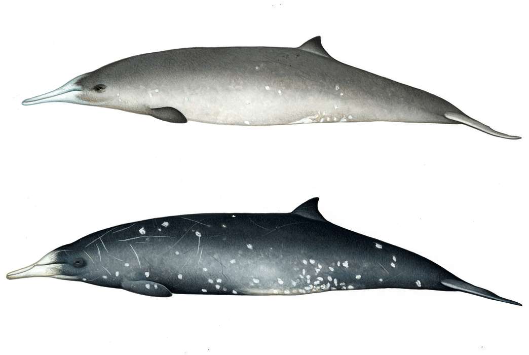
Elusive beaked whale species found to be ‘resilient’ to climate change
By Zack Fishman
Engineering
A smaller, more streamlined design can help virtual reality headsets go mainstream
By Beth Newhart
Mind & Behavior
Why do some TED Talks go viral? It's all about the speaker
By Tara DiMaio
Life Sciences
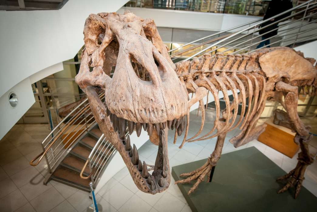
Billions of T. rex roamed the Earth during the Cretaceous
Life Sciences, Social Sciences
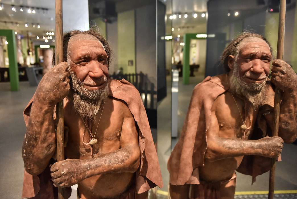
New DNA analysis techniques reveal twists in Neanderthal history
Life Sciences, Mind & Behavior, Engineering
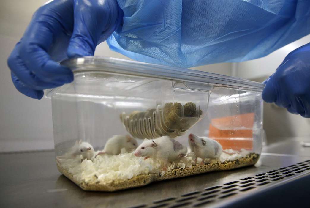
Tiny brain probe for mice could yield more data for neuroscientists
Engineering, Physical Sciences
Quantum computing just entered its internet era
Physical Sciences
Two-decade disagreement on quantum spin liquids put to rest with new findings
By Zack Fishman
Physical Sciences, Engineering
Super-reflective white paint is like ‘a passive air conditioner’
Life Sciences
Scientists used stem cells to create a hybrid human-monkey embryo